• Tentang UGM
  • Portal Akademik
  • Pusat TI
  • Perpustakaan
  • Penelitian
  • Informasi Publik
  • Bahasa Indonesia
    • Bahasa Indonesia
    • English
Universitas Gadjah Mada Universitas Gadjah Mada
Fakultas Geografi
  • Profil
    • Sejarah
    • Visi, Misi dan Tujuan
    • Sambutan Dekan
    • Manajemen
      • Pimpinan Fakultas
      • Senat Fakultas
      • Pengelola Departemen
      • Pengelola Program Studi
    • Civitas Akademika
      • Dosen
      • Staf Kependidikan
  • Pendidikan
    • Program Sarjana
      • Geografi Lingkungan
      • Kartografi dan Penginderaan Jauh
      • Pembangunan Wilayah
      • International Undergraduate Program
    • Program Pascasarjana
      • Program Studi Magister Geografi
      • Program Studi Magister Geografi Minat Pembangunan Wilayah
      • Program Studi Magister Geografi Minat MPPDAS
      • Program Studi Magister Penginderaan Jauh
      • Program Studi Doktor Geografi
    • Admisi
      • Program Sarjana
      • Program Pascasarjana
      • Program Fast Track S1 – S2
      • MATRIKULASI D4 ke S1
    • Akreditasi
  • Akademik & Kemahasiswaan
    • Peraturan Akademik
      • Panduan Akademik
      • Kode Etik Mahasiswa Geografi
      • Tata perilaku Mahasiswa UGM
    • Layanan Kemahasiswaan
    • Layanan Akademik
    • Kalender Akademik
    • Seputar Magang
    • Beasiswa
    • Organisasi Kemahasiswaan
    • Ikatan Profesi Dan Lembaga-Lembaga Lain
  • P2M
    • Penelitian & Pengabdian Masyarakat
    • Tracer Study
  • Kerja sama
    • Dalam Negeri
    • Luar Negeri
    • Alumni
  • Fasilitas
    • Akademik
    • Student Wellbeing
    • Peminjaman Ruang
    • Ruang Kebugaran
  • Beranda
  • Pos oleh
  • hal. 3
Pos oleh :

nailasalma

GDPK Perlu Review dan Transformasi ke Arah Pro-Natalis

RilisSustainable Development Goals Senin, 26 Mei 2025

Grand Design Pembangunan Kependudukan (GDPK) merupakan kerangka besar pembangunan kependudukan yang terdiri atas lima pilar utama: pengendalian kuantitas penduduk, peningkatan kualitas penduduk, pembangunan keluarga, penataan persebaran penduduk, serta data. 

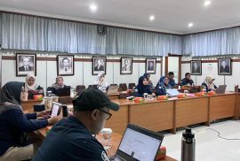
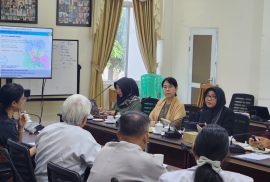
Dalam kegiatan Pertemuan Advokasi Grand Design Pembangunan Kependudukan Kabupaten Gunungkidul, Dr. Umi Listyaningsih, S.Si., M.Si., dosen sekaligus Kepala Laboratorium Kependudukan dan Sumberdaya Ekonomi Fakultas Geografi Universitas Gadjah Mada (FGe UGM) menyampaikan bahwa GDPK bukan sekadar dokumen formal, melainkan peta jalan kebijakan yang disusun secara logis dan berbasis empiris dengan melibatkan seluruh pemangku kepentingan. read more

FGE UGM Ajak Siswa SMA IA 9 Manfaatkan Peluang Studi Internasional Bidang Geografi

RilisSustainable Development Goals Kamis, 22 Mei 2025

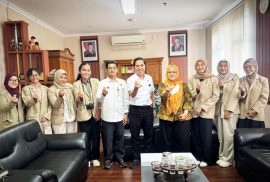
Fakultas Geografi Universitas Gadjah Mada (FGE UGM) mengajak para siswa SMA Islam Al Azhar (IA) 9 Yogyakarta untuk memanfaatkan peluang studi internasional melalui International Undergraduate Program (IUP). Terlebih, mendorong siswa untuk terlibat dalam studi internasional yang fokus pada geografi dan lingkungan. Hal tersebut disampaikan dalam sebuah sosialisasi di Auditorium Al Hafidz, Kamis (21/5).

Kegiatan ini sekaligus merupakan tindak lanjut kerja sama antara Fakultas Geografi UGM dan SMA Islam Al Azhar 9 Yogyakarta yang telah resmi ditandatangani pada awal tahun 2025.   read more

UGM dan NUS Dukung Zero Hunger Melalui Southeast Asia Friendship Initiative

RilisSustainable Development Goals Kamis, 22 Mei 2025

Dua fakultas di Universitas Gadjah Mada (UGM), yaitu Fakultas Geografi (FGE) dan Fakultas Teknologi Pertanian (FTP), melakukan kolaborasi dengan King Edward VII Hall, National University of Singapore (NUS), dalam kegiatan bertajuk “Expert Lecture and Case Study Collaboration on Sustainable Agricultural Supply Chains in the Rural-Urban Context” . Kegiatan ini berlangsung pada Selasa (20/5) di Fakultas Teknologi Pertanian UGM.

Kolaborasi antara ketiganya merupakan bagian dari Southeast Asia Friendship Initiative (SFI) sebagai upaya mendukung pencapaian Tujuan Pembangunan Berkelanjutan (SDGs), khususnya SDG 2 yakni Zero Hunger . read more

FGE UGM Jadi Mitra Utama dan Koordinator Wilayah Proyek Karbon Biru ASEAN-Timor Leste

RilisSustainable Development Goals Kamis, 22 Mei 2025

Fakultas Geografi Universitas Gadjah Mada (FGE UGM) kembali menunjukkan komitmennya dalam penguatan kolaborasi internasional di bidang perubahan iklim dan ekonomi biru. Hal ini ditandai dengan ditunjuknya FGE UGM sebagai mitra utama sekaligus regional coordinator dalam penyusunan seagrass blue carbon and peatland profile untuk wilayah ASEAN dan Timor Leste dalam acara The Launch Event of the ASEAN Blue Carbon and Finance Profiling (ABCF) Project.

Proses penyusunan profil tersebut dikoordinasikan oleh Prof. Dr. Pramaditya Wicaksono, S.Si., M.Si., dari Fakultas Geografi UGM bekerja sama dengan Kementerian Kelautan dan Perikanan (KKP), Badan Riset dan Inovasi Nasional (BRIN), dan Badan Informasi Geospasial (BIG). read more

The Economic and Poverty Impact of Migration: is Repeated Migration Better Than One-Way Migration?

Publikasi Rabu, 21 Mei 2025

Nanang Widaryoko | Sukamdi | Agus Joko Pitoyo
Cogent Social Sciences 2025, Vol. 11, no. 1, 2495858

Abstract

Scholarly discourse on migration has traditionally examined the welfare implications for migrants and non-migrants, yielding diverse perspectives. However, the conventional portrayal of migration as a one-way, overlooks the dynamic nature of contemporary migration, rendering discussions on the impact of migration less comprehensive. This study fills the gap by investigating the economic and poverty impacts of repeated migration versus one-way migration in Indonesia. Using panel data from the Indonesian Family Life Survey (IFLS) from 1993 to 2014, we apply a multinomial endogenous switching regression model and Propensity Score Matching (PSM) to analyze migration outcomes across different migration trajectories. Our findings reveal that migrants who engage in onward migration generally experience higher economic welfare than one-way migrants. Among one-way migrants, those who migrated as children have the highest economic outcomes, while one-way migration in adulthood tends to be less beneficial. In terms of poverty impact, migrants who moved as children have the most significant effect on poverty reduction, followed by onward migrants, while migrants who move as adults do not significantly reduce poverty. These results underscore the importance of considering migrant quality, migration duration, and migration trajectory in achieving migration outcomes. In addition, these findings show the importance of classifying migration as not only one way but also repeated migration. read more

Capturing The Dynamics of Aboveground Carbon Stock in Intertidal Seagrass Meadows Using Sentinel-2 Time-Series Imagery

Publikasi Rabu, 14 Mei 2025

Pramaditya Wicaksono | Amanda Maishella | Ramadhan

Remote Sensing Applications: Society and Environment, Volume 38, April 2025, 101552

Abstract

One of the challenges associated with the monitoring of seagrass meadows is the seasonal variability in percent cover, which is closely linked to the aboveground biomass carbon stock (AGC). To gain a comprehensive understanding of seagrass dynamics, it is essential to obtain spatial and temporal information on seagrass AGC. The most effective approach for mapping the dynamics of seagrass AGC is remote sensing; however, limited robustness of the mapping model limits their applicability across different locations. To address this issue, we developed a robust model for mapping seagrass AGC, with the objective of capturing the dynamics of seagrass AGC in intertidal seagrass meadows. Using seagrass field data and assuming that pure seagrass and sand pixels have 100 % and 0 % seagrass cover, respectively, we trained stepwise, machine learning (random forest, support vector machine, and multivariate adaptive regression spline), and deep learning (dense neural network) regression models to convert Sentinel-2 reflectance into seagrass AGC. The accuracy of the models was evaluated at multiple sites with available field data, and the results demonstrated an RMSE ranging from 6.28 to 13.97 g C m−2 and a correlation coefficient between 0.69 and 0.83. Overall, the SVM regression model exhibited the highest accuracy. The SVM model was subsequently applied to 13 seagrass sites across Indonesia over a 36-month period, revealing consistent and recurring monthly and bimonthly AGC patterns. The majority of seagrass meadows exhibited their highest AGC during the May–June period and their lowest during the September–October period. This study also represents the first time-series mapping of seagrass AGC in Indonesia on a monthly and bimonthly basis, marking a significant advancement in understanding seagrass’s potential as a blue carbon sink. Additionally, to achieve more accurate assessments of seagrass changes, it is crucial to account for the monthly and seasonal dynamics in seagrass growth patterns. read more

The Macroeconomic Impact of Population Aging in Indonesia: Do Older Adults Matter?

Publikasi Jumat, 9 Mei 2025

Titik Munawaroh | Sukamdi | Abdur Rofi | Umi Listyaningsih

Asian Economic and Financial Review Vol. 15 No. 3 (2025)

Abstract

Indonesia, the fourth most populous country globally, is approaching an aging population and is considered unprepared for its consequences. In this context, the effect of population aging on economic growth is a widely debated topic. Previous research has shown different perspectives, stating that population aging positively and negatively influences economic growth, while other analyses report an ambiguous relationship. Therefore, this research aimed to explore the phenomenon of population aging and its economic implications by using regional macro data at the district or city level from the official 2020 BPS-Statistics Indonesia publication. Using a linear regression method, the results showed that population aging, measured by the OADR (Old Age Dependency Ratio), both traditional and modified, possesses a substantial negative influence on economic growth. However, older workers contribute positively since an increase in labor force participation could mitigate the negative consequences of population aging. Increased inclusion of older adults in economic activities is also a potential strategy for mitigating the impact. The model suggests that this method reduces economic burdens associated with an aging population. However, further research is needed to determine the most effective methods to increase the inclusion of older adults in the workforce while safeguarding basic rights in terms of health and well-being. read more

Multitemporal Satellite Images For Monitoring The Volcanic Activities and Geothermal Potential of Ternate Island’s Gamalama Volcano, Indonesia’s densest Active Volcanic Island

Publikasi Kamis, 8 Mei 2025

Bondan Galih Dewanto | Danang Sri Hadmoko | Nurul Fitrah Ramadhani | Admiral Musa Julius

Remote Sensing Applications: Society and Environment Volume 38, April 2025, 101555

Abstract

Throughout history, Ternate, a diminutive volcanic island located in the North Maluku Province of Indonesia, has functioned as a significant center of the nation’s social and economic activity. The Gamalama Volcano constituted a significant element of Ternate Island’s topography, and its eruption resulted in substantial disruption. The aims of this current contribution are: to monitor the historical activities of the Gamalama volcano and understanding the geothermal potential to support the energy needs in Ternate Island. The multi-temporal analysis was conducted to monitor the activity of Gamalama Volcano, utilizing satellite imagery spanning a period of 50 years. The imagery sources included Landsat 1, Landsat 4, Landsat 5, Landsat 7, ASTER, and Landsat 8. The present study employed the single-channel algorithm to derive the land surface temperature (LST). The band combination and ratio were utilized to infer the geological context and geothermal capacity of the Gamalama Volcano. The analysis of normalized differential vegetation index (NDVI) utilized in the calculation of LST has revealed that vegetation growth has occurred subsequent to certain volcanic eruptions. As per the LST data, the average temperature of the surface within the crater escalated to 38.472 °C during the eruption of 1997, thereby establishing it as the maximum temperature recorded in the past half-century. The volcanic activity of Gamalama Volcano was elucidated through the utilization of the LST technique, which has the capacity to cover various temporal intervals. The congruence between the LST data derived from Landsat and ASTER data substantiates the dependability of the LST methodology. The geothermal potential of approximately 16 °C has been observed in the crater and sand region of the volcano, along with the identification of supplementary hot spots in the north-eastern and western regions of the volcano’s primary structure. The utilization of Landsat 8 band combinations and band ratios has substantiated the presence of an area exhibiting elevated geothermal potential within the andesite and basaltic andesite geological formations. The practicality of utilizing multi-source optical satellites for monitoring volcanic activity has been exemplified by the multiple eruptions that have occurred at Gamalama Volcano. Furthermore, this technology could potentially be employed for conducting exploratory research into the geothermal potential of the region.
read more

Karst Rocky Desertification Delineation and Estimation of Potential Soil Loss in Tropical Karst Cockpits

Publikasi Kamis, 8 Mei 2025

Rakhmat Dwi Putra | Tjahyo Nugroho Adji | Eko Haryono

Kuwait Journal of Science, Volume 52, Issue 3, July 2025, 100422

Abstract

Tropical cockpit karst, characterized by hilly topography, steep slopes, and thin soil layers, is highly susceptible to land degradation in the form of karst rocky desertification (KRD). KRD occurs due to acute soil erosion in karst environments, leading to the exposure of bedrock. This study aims to provide a comprehensive analysis of KRD, accurately assess soil erosion rates in cockpit karst landscapes, and identify the contributing factors. The research was conducted within the Seropan underground river catchment area in the Gunungsewu Karst region. KRD was identified using an image transformation approach employing the Karst Rocky Desertification Index (KRDI). Soil loss estimation was performed using the updated Revised Universal Soil Loss Equation (RUSLE) method, incorporating the KRD factor to enhance its applicability in karst environments. The results demonstrate that KRDI is highly effective in identifying KRD. Approximately 40 % of the study area exhibits moderate to severe KRD levels, predominantly found on the slopes of conical hills, where the primary driving factors are deforestation, land clearing for dryland agriculture, and abandonment of agricultural land. The estimated total soil loss in the study area is 4975.01 tons per year, with the highest contribution occurring at the intense soil loss level. The intense to extremely intense-severe soil loss levels are correlated with the steep slopes of conical hills, highlighting the significant role of topography in soil degradation within tropical karst environments.

View Publication
read more

Trigger Change! Innovations in Sustainable Urban Land Restoration Course Launch Program

RilisSustainable Development Goals Rabu, 7 Mei 2025

Urbanization has brought innovation, employment but also pollution, heat, land degradation and a human health crisis. The challenge is how to revitalize degraded urban areas, while prioritizing ecological, social, and economic sustainability. Tackling these challenges requires innovative and transdisciplinary approaches to land restoration that are not adequately covered in most urban planning /landscape architecture university courses. 

To help bridge this gap,  we have launched (07/05) an open source global course, intended for universities and training institutions in the fields of urban planning / landscape architecture/ urban geography/ land administration and related courses worldwide. You will learn how you can access it, what this course is about and about related upcoming networking and training opportunities. read more

12345…13

Rilis Berita

  • FGe UGM Adakan Pelatihan Geo-AI for Carbon Storage Assessment
  • Dies Natalis ke-62 Resmi Dibuka, FGe UGM Usung Tema “Geografi Lestari”
  • UGM dan Guilin University of Technology Perkuat Kolaborasi Internasional melalui Joint Lecture

Link Pendaftaran

Link Fakultas Geografi

Universitas Gadjah Mada

Fakultas Geografi Universitas Gadjah Mada
Sekip Utara, Bulaksumur, Yogyakarta 55281
Phone +62-274-6492340| 589595
Email: geografi@ugm.ac.id
Instagram : @geografiugm

Tentang

  • Sejarah
  • Visi Misi Tujuan
  • Pimpinan Fakultas
  • Senat Fakultas
  • Daftar Dosen Pengajar

Departemen

  • Geografi Lingkungan
  • Sains Informasi Geografi
  • Geografi Pembangunan
  • Pengelola Departemen
  • Pengelola Program Studi

Kemahasiswaan

  • Organisasi Kemahasiswaan
  • Layanan Kemahasiswaan
  • Seputar Magang

Layanan Terpadu

  • Heregistrasi
  • Surat Kemahasiswaan
  • Virtual Office Akademik

Informasi Publik

  • Permohonan Informasi Publik
  • Daftar Informasi Tersedia Setiap Saat
  • Daftar Informasi Tersedia Secara Berkala
Flag Counter

© 2018 Fakultas Geografi Universitas Gadjah Mada | IG: geografiugm

KEBIJAKAN PRIVASI/PRIVACY POLICY