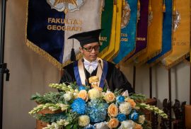
Tidak semua api perjuangan lahir dari dukungan, sebagian justru menyala dari keraguan, penolakan, dan hal-hal yang sempat menjatuhkan kita. Namun bagi R. Muhammad Syarif Abdurrahman yang akrab disapa Syarif, api itu justru menyala dari titik yang tidak ideal. Dari perasaan gagal di tempat yang paling ingin ia buktikan.
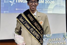
Syarif, mahasiswa Program Studi Kartografi dan Penginderaan Jauh, Departemen Sains Informasi Geografis, Fakultas Geografi Universitas Gadjah Mada, mengenal perasaan itu dengan baik. Dan dari sanalah ia melangkah. Meraih Juara 1 Pemilihan Mahasiswa Berprestasi (PILMAPRES) Fakultas Geografi 2026 dan Juara 2 PILMAPRES Universitas Gadjah Mada Kategori Sarjana 2026.