• Tentang UGM
  • Portal Akademik
  • Pusat TI
  • Perpustakaan
  • Penelitian
  • Informasi Publik
  • Bahasa Indonesia
    • Bahasa Indonesia
    • English
Universitas Gadjah Mada Universitas Gadjah Mada
Fakultas Geografi
  • Profil
    • Sejarah
    • Visi, Misi dan Tujuan
    • Sambutan Dekan
    • Manajemen
      • Pimpinan Fakultas
      • Senat Fakultas
      • Pengelola Departemen
      • Pengelola Program Studi
    • Civitas Akademika
      • Dosen
      • Staf Kependidikan
  • Pendidikan
    • Program Sarjana
      • Geografi Lingkungan
      • Kartografi dan Penginderaan Jauh
      • Pembangunan Wilayah
      • International Undergraduate Program
    • Program Pascasarjana
      • Program Studi Magister Geografi
      • Program Studi Magister Geografi Minat Pembangunan Wilayah
      • Program Studi Magister Geografi Minat MPPDAS
      • Program Studi Magister Penginderaan Jauh
      • Program Studi Doktor Geografi
    • Admisi
      • Program Sarjana
      • Program Pascasarjana
      • Program Fast Track S1 – S2
      • MATRIKULASI D4 ke S1
    • Akreditasi
  • Akademik & Kemahasiswaan
    • Peraturan Akademik
      • Panduan Akademik
      • Kode Etik Mahasiswa Geografi
      • Tata perilaku Mahasiswa UGM
    • Layanan Kemahasiswaan
    • Layanan Akademik
    • Kalender Akademik
    • Seputar Magang
    • Beasiswa
    • Organisasi Kemahasiswaan
    • Ikatan Profesi Dan Lembaga-Lembaga Lain
  • P2M
    • Penelitian & Pengabdian Masyarakat
    • Tracer Study
  • Kerja sama
    • Dalam Negeri
    • Luar Negeri
    • Alumni
  • Fasilitas
    • Akademik
    • Student Wellbeing
    • Peminjaman Ruang
    • Ruang Kebugaran
  • Beranda
  • Pos oleh
Pos oleh :

geo

Dosen Fakultas Geografi sebagai Keynote Speaker pada International Forum of Social Design on Migration, Environment and Sustainability di Tamkang University Taiwan

Rilis Jumat, 24 Maret 2023

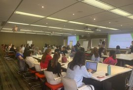
Roundtable discussion di Hongkong University

Dosen Departemen Geografi Lingkungan, Fakultas Geografi UGM yaitu Dr. Sukamdi, M.Sc. melakukan kunjungan akademik ke beberapa universitas di Taiwan dan Hongkong antara lain National Chengchi University, Tamkang University, dan Hongkong University pada tanggal 22—25 Maret 2023. Rangkaian kunjungan terdiri dari Roundtable discussion dengan Lembaga Swadaya Masyarakat, akademisi, dan pemerintah yang membicarakan terkait pekerja migran domestik bertempat di Hongkong University. Selain itu Dr. Sukamdi juga diundang oleh College of Foreign Languages and Literature (National Chengci University) sebagai salah satu keynote speaker pada International Forum of Social Design on Migration, Environment and Sustainability yang diselenggarakan di Tamkang University pada tanggal 22 Maret 2023. Keynote speakers terdiri dari para dosen/peneliti dari National Chengchi University (Le Thi-Nham, Tim Schuetz, dan phil. Vissia Ita Yulianto) serta Dr. Pande Made Kutanegara (Fakultas Ilmu Budaya UGM) dan Hakimul Ikhwan, Ph.D. (Fakultas Ilmu Sosial dan Politik UGM). Para tamu undangan juga bertemu dan berdiskusi dengan pengelola fakultas dan ketua program sarjana Southeast Asian Languages and Cultures, serta kunjungan ke beberapa fasilitas akademik bagi dosen dan mahasiswa yang berada disekitar National Chengci University. (UKLN) read more

International Symposium of Polycentric Approaches of the Management of Urban Waters” Responding to water and urban development challenges of cities in Southeast Asia”

Rilis Jumat, 24 Maret 2023

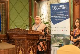
Figure 1. Utia Suarma as one of the representative PolyUrbanWaters team Indonesia from the Faculty of Geography UGM present the case study of Sariharjo Village.

The PolyUrbanWaters project (www.polyurbanwaters.org) aims to generate scientific knowledge and develop practical tools that will enable rapidly growing urban areas in Southeast Asia to implement polycentric approaches to urban development and integrated, multi-sectoral water management. PolyUrbanWaters is a research and project network funded by the German Federal Ministry of Education and Research (BMBF) that consists of academic institutions, municipalities, local and national government agencies, civil society and private-sector stakeholders from Indonesia, Cambodia, Laos, Thailand, Vietnam and Germany.
The Indonesian Team consist of Faculty of Geography UGM, Department of Architecture and Planning (Faculty of Engineering UGM), Kota Kita, AKSANSI, Head of Sariharjo Village, and BAPPEDA of Sleman Regency. read more

Transformative Futures: Climate / Sustainable South East Asia 2023

Rilis Selasa, 21 Maret 2023

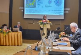
Dr. Hizbaron delivered her speech at the first session at the conference.

The transformative futures: climate/sustainable South East Asia 2023 is a collaborative event hosted by Rijks Universiteit of Groningen, University of Thammasat, and Universitas Gadjah Mada [https://www.rug.nl/wubbo-ockels-school/calendar/2023/transformative-futures/]. The conference is part of the long process of 2030 Agenda for Sustainable Developments and Paris Climate Agreement. The main ideas of this event is to develop synergies in the implementation of the sustainable development and climate change agendas facing cities in Southeast Asia. read more

Guest Lecture from the Faculty of Geography UGM at Asian Institute Technology (AIT)

Rilis Selasa, 21 Maret 2023

Department of Disaster Preparedness, Mitigation and Management (DPMM), Asian Institute of Technology has invited Dr. Dyah Rahmawati Hizbaron to provide a guest lecture on 15th March, 2023. The event was given as a follow up collaboration between Faculty of Geography UGM and DPPM, AIT which has lasted from 2019. The idea of the guest lecture is to share the idea of Implementation of SDGs, DRR and CCIA Praxis in Natural Resource Management. The event was attended by Associate Professor Mokbul Morshed Ahmad, PhD, and students from the Master Program. read more

Gandeng Hokkaido University, PUSPICS Fakultas Geografi UGM Selenggarakan Hands-on Training Workshop mengenai Pertanian Presisi Menggunakan Drone

Rilis Senin, 20 Maret 2023

Bidang pertanian merupakan salah satu bidang yang mengalami perkembangan dari waktu ke waktu di Indonesia. Seiring dengan perkembangan teknologi, teknologi geospasial dapat dimanfaatkan dalam bidang pertanian, khususnya pada pengaplikasian teknologi pertanian. Smart farming dan precision farming adalah metode dari Smart Farming Precision Agriculture 4.0. Smart farming adalah penggunaan platform yang dihubungkan dengan perangkat teknologi dalam pengumpulan informasi pertanian yang diperoleh dari lapangan dengan perangkat pengukur atau sensor yang ditanamkan pada lahan pertanian. Precision Agriculture menekankan kepada penggunaan input berupa pestisida, pupuk dan tindakan lain yang sesuai kebutuhan berdasarkan informasi olahan data pada perangkat teknologi sehingga dosis pengaplikasian dapat sesuai dengan yang seharusnya. Contoh penerapan precision farming dapat diterapkan pada analisis pengaplikasian pupuk dan pestisida. Adapun dampak baik yang ditimbulkan pada pengaplikasian pupuk atau pestisida sesuai kebutuhan akan menjaga kesehatan dan kelestarian tanah, optimalisasi penggunaan input, dan menghemat biaya. read more

Fakultas Geografi UGM Gelar Kuliah Umum Datangkan Narasumber dari PT Freeport Indonesia

Rilis Senin, 6 Maret 2023

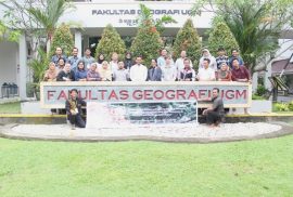
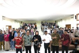
Fakultas Geografi Universitas Gadjah Mada (UGM) menggelar Kuliah Umum bersama PT Freeport Indonesia dengan mengusung tema “Pengelolaan Lingkungan di Area Pertambangan PT Freeport Indonesia”. Acara dilaksanakan pada hari Selasa, 28 Februari 2023 pukul 09.00 sampai dengan 12.00 di Auditorium Merapi, Fakultas Geografi UGM. Narasumber yang hadir adalah Dr. Gesang Setyadi, S.T., M.B.A. selaku Vice President Enviromental/Sustainable Development PT Freeport Indonesia dan Arland C. Suruan selaku External Outreach CorCom PT Freeport Indonesia. Para narasumber membawakan materinya dan berdiskusi dengan audiensi kuliah umum dengan dimoderatori oleh Dr. Dyah Rahmawati Hizbaron, S.Si., M.T., M.Sc. read more

Development of the triangle method for drought studies based on remote sensing images: A review

Publikasi Senin, 9 Januari 2023

A Sediyo Adi Nugraha | Muhammad Kamal | Sigit Heru Murti | & Wirastuti Widyatmanti

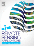
Remote Sensing Applications: Society and Environment Volume 29, January 2023, 100920

Abstract

Mapping and monitoring drought supports climate change adaptation of resilient ecosystems. The temporal and spatial scale aspects of drought can be efficiently mapped with remote sensing imagery. So far, remote sensing data for drought mapping has focused on the relationship between the vegetation index and surface temperature with various limitations. The interplay between surface temperature and vegetation index (Ts/VI) is well-known in drought research and related studies, such as the triangle method. In 2002, Temperature Vegetation Dryness Index (TVDI) was introduced to model this interplay. Various scholars have explored Ts/VI interaction to determine dry and wet edges and to develop models based on triangle method concepts to monitor drought. However, drought information from Ts/VI identification is not sufficient to justify meteorological, agricultural, or hydrological drought. To address this issue, the TDVI model has been compared with various single indices (VHI, VCI, VDI, TCI, SPI) to reveal their respective advantages and disadvantages. This article reviews several studies that draw on Ts/VI interaction to ascertain dry and wet edges and develop drought identification models with other dryness indicators, such as soil moisture, precipitation, and vegetation change. In general, dry and wet edges are determined using three methods: linear, parabolic, and quadratic, which share a relatively moderate relationship with soil moisture in the field. Most developed models target the determination of dry and wet edges (VTCI, iTVDI, MTVDI) and the addition of potential indicators that may be related to Ts/VI, such as TVMDI, TVMPDI, TVPDI, and TVSDI. Elevation, a manifestation of regional physiographic characteristics, is combined with the Ts/VI concept to create three-dimensional visualizations of the interaction and constantly generate related indicators. read more

UAV Mapping Workshop in Kota Kinabalu, Malaysia: Involvement of Faculty of Geography in APN for Global Change Research Project

Rilis Minggu, 17 Juli 2022

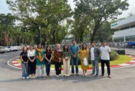
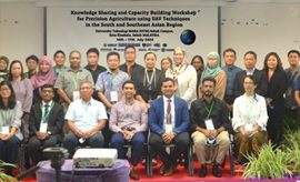
Group photo of the workshop participants

Universiti Teknologi MARA Sabah hosted a workshop on 13-17 July 2022 in Kota Kinabalu, Malaysia, as the first program of a series of trainings to be conducted across 5 Asian nations including Malaysia, India, Vietnam, Bangladesh, and Indonesia. A project entitled “Knowledge Sharing and Capacity Building Workshop for Precision Agriculture using UAV Techniques in the South and South-East Asian Region” is an international project in a collaboration between Hokkaido University, Indian Institute of Technology Roorkee, Sant Longowal Institute of Engineering and Technology, Universiti Teknologi MARA, Jahangirnagar University, Universitas Gadjah Mada, and Can Tho University. A funding was provided by Asia-Pacific Network Global Change Research. Faculty of Geography UGM delegated Dr. Wirastuti Widyatmanti, with Kurniawan Nugroho, M.Sc. and Deha Agus Umarhadi, M.Sc. as team members in the workshop. read more

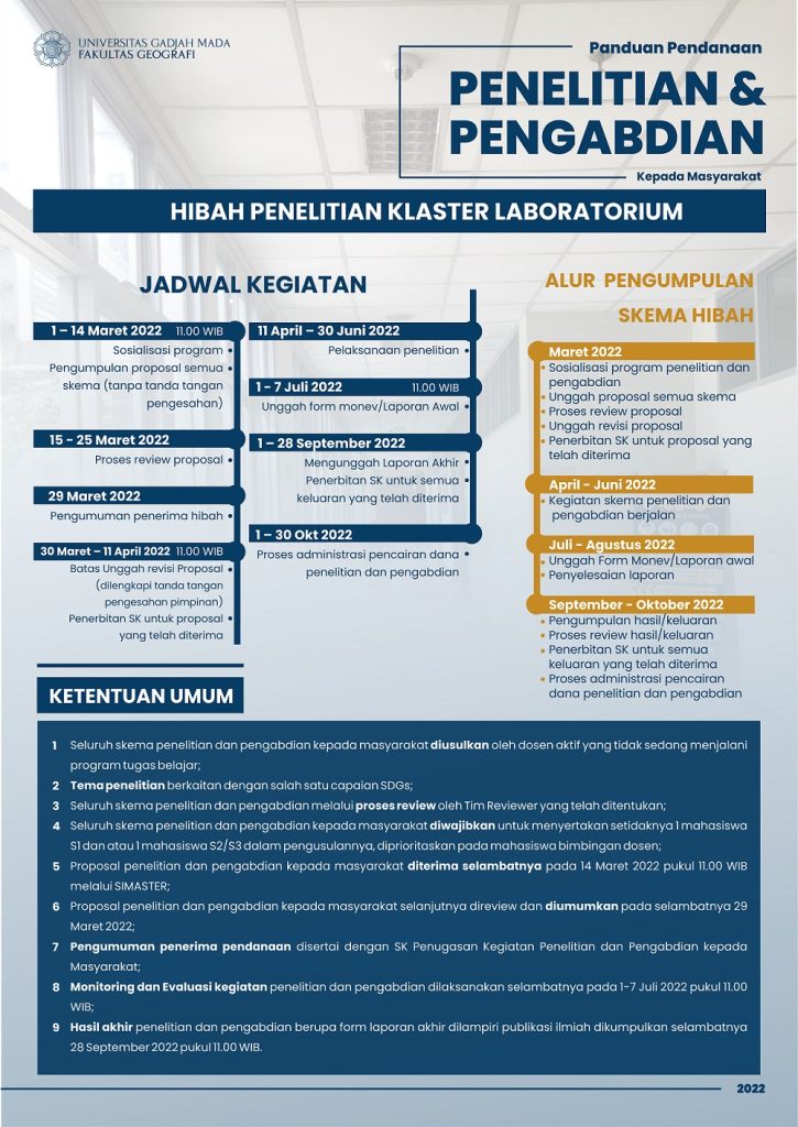
Panduan Pendanaan Penelitian dan Pengabdian kepada Masyarakat

Rilis Kamis, 10 Maret 2022


HIBAH-PENELITIAN-KLASTER-LABORATORIUM

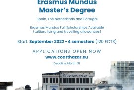
Scholarship Alert: Erasmus Mundus Joint Masters – Coastal Hazards (COASTHazar)

Rilis Senin, 7 Maret 2022

Target: Alumni S1 Fakultas Geografi UGM

Fakultas Geografi UGM merupakan salah satu Associated Partners pada program Erasmus Mundus Joint Masters – Coastal Hazards (COASTHazar). Untuk itu kami mengundang para alumni S1 Fakultas Geografi yang berminat melanjutkan studi ke jenjang S2 untuk mendaftarkan diri.
COASTHazar merupakan program S2 dengan durasi 4 semester (120 ECTS) yang diselenggarakan secara kolaboratif oleh Universidad de Cantabria (Santander, Spanyol), IHE Delft (Belanda), dan University of Algarve (Faro, Portugal). Mahasiswa akan melakukan mobilisasi antar semester ke tiga negara yaitu semester 1 di Spanyol, semester 2 di Belanda, semester 3 di Portugal, dan untuk penyelesaian thesis dapat menyesuaikan di ketiga lokasi tersebut. read more

12

Rilis Berita

  • The Macroeconomic Impact of Population Aging in Indonesia: Do Older Adults Matter?
  • Multitemporal Satellite Images For Monitoring The Volcanic Activities and Geothermal Potential of Ternate Island’s Gamalama Volcano, Indonesia’s densest Active Volcanic Island
  • Karst Rocky Desertification Delineation and Estimation of Potential Soil Loss in Tropical Karst Cockpits

Link Pendaftaran

Link Fakultas Geografi

Universitas Gadjah Mada

Fakultas Geografi Universitas Gadjah Mada
Sekip Utara, Bulaksumur, Yogyakarta 55281
Phone +62-274-6492340| 589595
Email: geografi@ugm.ac.id
Instagram : @geografiugm

Tentang

  • Sejarah
  • Visi Misi Tujuan
  • Pimpinan Fakultas
  • Senat Fakultas
  • Daftar Dosen Pengajar

Departemen

  • Geografi Lingkungan
  • Sains Informasi Geografi
  • Geografi Pembangunan
  • Pengelola Departemen
  • Pengelola Program Studi

Kemahasiswaan

  • Organisasi Kemahasiswaan
  • Layanan Kemahasiswaan
  • Seputar Magang

Layanan Terpadu

  • Heregistrasi
  • Surat Kemahasiswaan
  • Virtual Office Akademik

Informasi Publik

  • Permohonan Informasi Publik
  • Daftar Informasi Tersedia Setiap Saat
  • Daftar Informasi Tersedia Secara Berkala
Flag Counter

© 2018 Fakultas Geografi Universitas Gadjah Mada | IG: geografiugm

KEBIJAKAN PRIVASI/PRIVACY POLICY